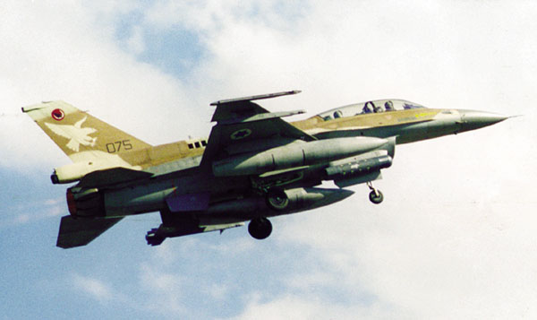
To z pierwszej fotki wygląda na zestaw Spice Stand-Off Precision Guidance Munition (PGM) Kit.
http://en.wikipedia.org/wiki/Precision-guided_munition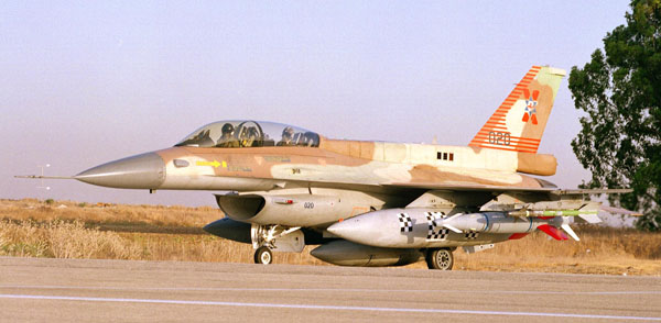
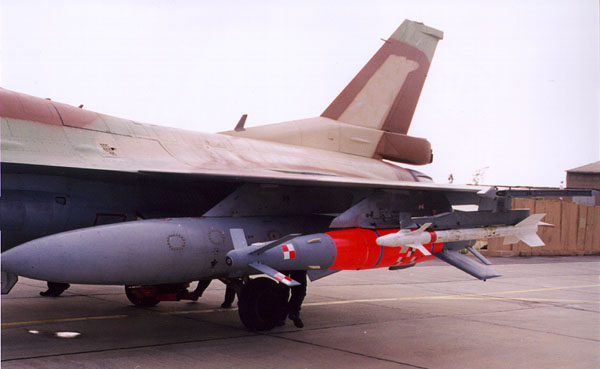
Z drugiej:
Litening
Day/Night Navigation and Targeting Pod
Litening is a combat-proven multi-spectral airborne targeting and navigation pod. It is designed for navigation and target illumination to improve day and night attack capabilities. Litening presents pilots with real-time, Forward Looking Infra-Red (FLIR) and Charge Coupled Device (CCD) imagery. The high sensor resolution enables pilots to reliably identify the combat objects and consequently to avoid collateral damage. It is fully operational 24 hours a day and in adverse weather conditions.
The sensors are incorporated in a single pod and provide the fighter aircrew with the flexibility to perform multiple missions/tasks including:
*
Laser spot detection enabling co-operative missions with target hand-over
*
Laser marking for co-operative missions with Night Vision Goggles (NVG)
*
Performance of low level night flights (navigation)
*
EO Point and Area Tracker & Inertial Tracker
*
Identification of aerial targets from Beyond Visual (BV) ranges
*
Detection/Recognition/Identification/Laser designation of surface targets
*
Accurate delivery of laser guided bombs; GPS guided munitions, cluster and general purpose bombs and reliable damage assessment
*
Integration capability to all Aircraft
Lub:
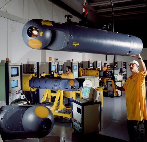
Reccelite
Day/Night Electro-Optical Reconnaissance Pod
The RecceLite is a self-contained self-cooled multi-sensor tactical reconnaissance system, consisting of an airborne pod based on the Litening Targeting and Navigation Pod and a ground exploitation station.
The RecceLite simultaneously collects Infra-Red (IR) and Visual (VIS and near IR) digital images within a very wide field of regard, in accordance with an automatic mission plan and/or manual operation. The images and the data annotation are recorded on a solid state recorder and transmitted to the exploitation station via the RecceLite data link. The Images are then interpreted at the ground exploitation station.
The concept comprises a single pod system, with a single sensors payload having sensors in both IR (infrared) and VIS (visual and near infrared) wavebands, having three fields of view (FOV) in IR and four in VIS, and the capability to direct the line of sight of all sensors towards any direction in space (excluding aircraft obscurations).
The sensors are using large two-dimensional focal plane arrays (FPA) mounted on a 4-axis gimbals system, and images are captured by scanning with the gimbals, and taking snapshots of the targets area. The line of sight is accurately directed towards the targets area using an onboard inertial navigation system (INS), and motion compensation in all directions is achieved by locking the sensors line of sight on the region of interest (ROI) while capturing images. Motion compensation is using advanced inertial tracking and digital elevation maps (DEM) embedded in the pod.